Thor Mining identifies gold clusters at Ragged Range

Pic: John W Banagan / Stone via Getty Images
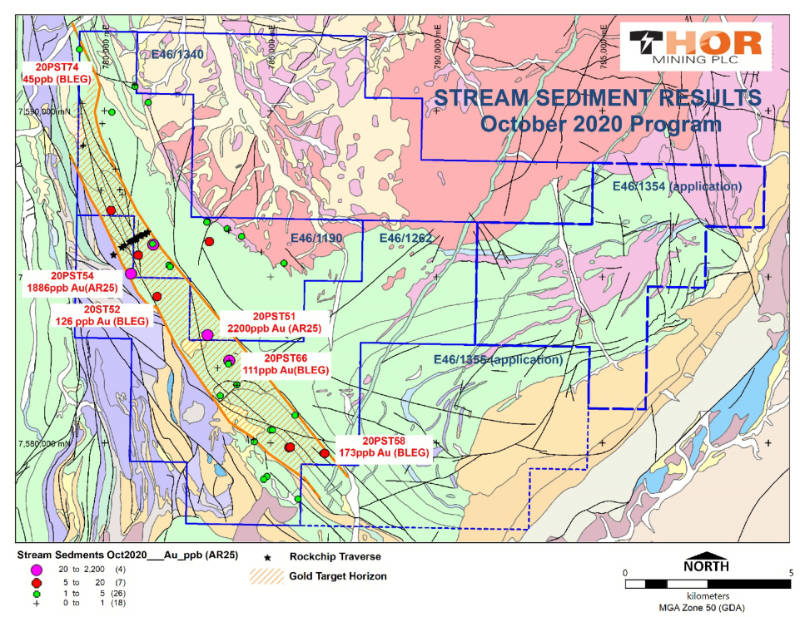
Special Report: Thor Mining’s third phase of stream sediment sampling has defined four distinct clusters of consistent gold mineralisation at its Ragged Range project.
The sampling returned results of up 2.2 grams per tonne gold and validates the mineralisation potential along the 13km anomalous corridor that trends through the interpreted thrust-faulted mafic-ultramafic contact.
Geochemical data analysis is continuing with Thor Mining (ASX:THR) proposing to carry out field mapping and soil sampling over priority targets to further delineate coherent gold trends prior to drilling.
“These are very exciting times for Thor at Ragged Range, as this project continues to exceed expectations,” executive chairman Mick Billing said.
“A number of very promising drill targets appear destined for testing, and we expect that the interpretation of the airborne magnetic survey results (near completion) should confirm several of these.”
Ragged Range
Thor recently acquired two additional licences adjacent to its existing Ragged Range gold and nickel project, increasing the project footprint by 73sqkm to 213sqkm.
It lies on the eastern boundary of the Greatland Gold Panorama project and predominantly comprises of Eastern Pilbara greenstone, highly prospective for both gold and nickel.
Visible gold has been observed in previous stream sediment sampling.
The company has previously flagged that the project has the potential to host a significant gold-bearing system.
This article was developed in collaboration with Thor Mining, a Stockhead advertiser at the time of publishing.
This article does not constitute financial product advice. You should consider obtaining independent advice before making any financial decisions.
Related Topics

Related Stories


UNLOCK INSIGHTS
Discover the untold stories of emerging ASX stocks.
Daily news and expert analysis, it's free to subscribe.
By proceeding, you confirm you understand that we handle personal information in accordance with our Privacy Policy.